Central and South Brazil are more populated than other regions because they are home to the country’s largest cities, Rio de Janeiro, Sao Paulo, Belo Horizonte and Brasilia. This is the region where Brazilian geography has been affected most by human activity. This region is where the economic heart of the country beats.
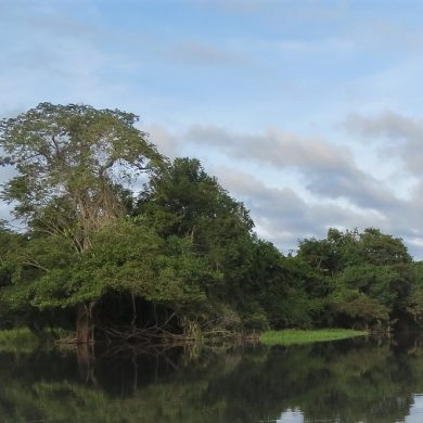
The Centre of Brazil forms a vast region characterized by 3 main types of ecosystems. The tropical forest dominates the northern part of the largest state, Mato Grosso. The neotropical savannah called Cerrado (which means thick, dense) occupies most of the space between the bottom of the Amazon rainforest and the southern forests. Brasilia, the capital of Brazil is located in the heart of this environment. The Pantanal, which comes from pantano meaning swamp in Portuguese, is characterized by a wide marshy plain flooded more than four months a year and interspersed with forest-covered hills. The Pantanal has an ecosystem of unique richness and ample wildlife.
Southern Brazil has a humid subtropical climate with relatively dry but more pronounced winters than the rest of the country and hot summers with abundant rainfall.

Central Brazil, wilderness and agriculture
The state of Mato Grosso, with 2,800,000 inhabitants spread over 900,000 km2, occupies a large part of west-central Brazil. This area of rainforest and swamps is a true ecological sanctuary. It includes the Mato Grosso Plateau, located in the center and south-east of the state and is the watershed between the Amazon basin in the north and that of Paraguay in the south. Formed of chapadas (high plateaus), its vegetation is dominated by the cerrado (Brazilian savannah).
This region also includes the Pantanal Natural Park, part of which is in the state of Mato Grosso do Sul. It is a vast expanse of 50 000 km2 which is one of the richest places in the world in terms of biodiversity and is home to a unique ecosystem. Deeply affected by deforestation and ecological fragmentation because of roads and intensive agriculture, the region is still protected and is being reforested sustainably. Its climate is very wet and tropical, with an annual temperature of 26 ° C. There is more than 1,000 mm of rain annually. Therefore nature is teeming but more open than in the Amazon and very rich in varied wildlife including the capybaras and caimans who live there by the thousands. It is also the area with the highest density of jaguars in the world.
Out of the forest, Mato Grosso, Mato Grosso do Sul and Goias are essentially agrarian states with an economy based on cattle and soybean farming. Although few areas within these territories are cultivated or reserved for livestock, the proportion tends to increase because of the advancing of the pioneer front and deforestation due to growing agricultural activity caused by high demands in food and agrofuel (bioethanol).
Thus, 70% of Mato Grosso’s GDP comes from agriculture and livestock. Farms produce 18 million tons of soybeans and 29 million cattle. Thanks to this region, Brazil remains the world’s leading producer and exporter of soybeans. Other crops in the region are cotton, rice, sugar cane and maize.
East of Mato Grosso is the state of Goiás. Situated on a mid-altitude plateau (8/900 m), it is covered with the characteristic bush savanna Cerrrado and some tropical forests border the rivers that cross it, the Paranaiba, Araguaias and Tocantins Rivers. Its capital is Goaina. There is also the border with Minas Gerais which marks the beginning of the Southeast region the Federal District. This is where Brasilia, which became the administrative capital of Brazil in 1960, left the business hub in São Paulo and that of culture in Rio de Janeiro.
The population of Goiás has greatly increased since 1950 and now stands at nearly 6 million, for a state of 350,000 km2. The climate of the Goiás plateau is subtropical. Temperatures remain reasonable, ranging from 26 ° C during the hottest month to 22 ° C during the coldest month.
The state of Tocantins was created in 1988 at the expense of the northern part of Goiás. The construction of a new capital, Palmas, began in 1989, although several cities in the state dating from the time of Portuguese colonization could have claimed this title, Araguaína being the most important city. Geographically, it is a hinge region between the north influenced by the tropical climate of the Amazon rainforest. The south and the Nordeste are more arid. It is a state of great wealth, both agricultural with huge herds of livestock and hydraulic thanks to a dam on the Rio Tocantins that provides electricity to the whole state.
South Brazil, active and effervescent
The South of Brazil gathers 40% of the Brazilian population on barely 10% of the territory. Comprising of the megacities of São Paulo and Rio de Janeiro, the Southeast is the economic heart of the country, accounting for nearly 60% of Brazil’s GDP. Along the coastline lies the Ribeira Valley, a splendid coast penetrated by deep bays.
Minas Gerais is the largest state in southern Brazil, covering 586,522 km2 and home to nearly 21 million inhabitants. The Portuguese settlers dug “common mines” that have ensured the prosperity of the Portuguese crown between the late seventeenth and early nineteenth century. The state is still rich in precious stone mines especially emerald mines. Colonized early to exploit this mineral wealth, the region has an important heritage of baroque architecture, witness to this prosperous era.
Former capital of the state, Ouro Preto owes its name, “Black Gold”, to the coffee that ensured its economic reputation. It is built on several hills with relatively steep slopes, from which you can enjoy splendid viewpoints, which gives it a special cachet. The city is listed as a World Heritage site by UNESCO.
Belo Horizonte is more modern, since it was founded in the late nineteenth century. Current state capital, it is the third largest city in Brazil after Rio and São Paulo, with more than 2,300,000 inhabitants. Resolutely turned towards the future and culture, this city boasts an exceptional and surprising open-air contemporary art museum, Inhotim, located 60 km from the capital. Minas Gerais is one of the country’s most landscaped states with abundant population and most of its ground used for agriculture and livestock. It also has the largest road network in the country in terms of density.
Located on the edge of the Atlantic Ocean, Espirito Santo is a small state that follows the transition between the plateaus of Minas Gerais and the coastal plain. Its varied economic activity, including crops, livestock and iron industries, make it one of the major players in the prosperity of the country. In addition, its coast and beaches are very popular with tourists.

The essential Rio de Janeiro
Further south, and we arrive in the state of Rio de Janeiro and its iconic city which needs no introduction. A true symbol of Brazilian exuberance and the cradle of culture, Rio is the second largest city in the country after São Paulo (more than 6 million inhabitants, twice as many for the whole agglomeration). Most of the city is part of a geological structure called the “Brazilian Crystal”. The many rocks and granites, forming the base of this crystal, are the oldest of the Brazilian territory. Several tectonic upheavals have ultimately resulted in the hills, mountains and valleys that characterize the Rio coast. The “Pão de Acucar” (the “Sugar Loaf”) and the “Corcovado” are the best known and the most symbolic of Rio Bay.
The climate is that of a tropical savannah: the average annual temperature is 24 ° C and the rainfall is about 1,200 mm per year. The city is located in the southern hemisphere so the summer season lasts from December to March and is wetter than the winter season, which lasts from June to September.
In addition to tourism and sport (Rio hosted the FIFA World Cup in 2014 and was Olympic city in 2016), economic resources of the megalopolis rely on major industrial clusters such as metallurgy, steel, mechanics, chemistry, agri-food, paper, mining or shipbuilding. Discovered about 40 years ago, oil is extracted not far from the coast on off-shore platforms and has placed the region at the top of the country’s oil producing areas.
On the coast further south is Brazil’s largest Atlantic forest reserve, the Costa Verde, home to the small colonial town of Paraty and Ilha Grande, which delight lovers of allure in idyllic settings of turquoise sea and lush vegetation.
Still further south is the sprawling agglomeration of São Paulo. A city of business with modern and expansive architecture, it is the most populated of Brazil (11 million inhabitants) and the third megalopolis of the Americas after Mexico city and New York with nearly 22 million souls. Its climate is considered humid subtropical, with some influence from the monsoon that can cause violent tropical storms in summer.
The economic heart of Brazil and Latin America, São Paulo has all types of industry and commerce, including automotive, aerospace, electronics, metallurgy. Virtually every major global company has a head office in São Paulo, either to sell in the Brazilian market or to produce in Brazil and export. The economic heart of Brazil has many monuments to visit, parks or museums and also hosts important artistic and sports events, such as the Formula 1 Grand Prix on the Interlagos circuit.
Following this we meet the prosperous state of Santa Catarina and its capital Florianópolis. With its highly contrasting relief, between the coast lined with plains and islands and its mountainous interior, it is known as the coldest state of Brazil. This is the only state where it sometimes snows in winter. Its economy is mainly oriented towards industry and agriculture with the production of wheat, rice, potato, fruit but also livestock breeding.

Iguaçu, a Brazilian wonder
Further to the south of Brazil, the state of Paraná is famous for the Iguazu Falls, these cascades of swirling waters that spring from the jungle, form the border between Argentina and Brazil. This wonder of nature is one of the most visited sites in the world. At Iguaçu, 275 waterfalls are spread over almost three kilometers stretching between the two neighboring countries.
All the waterfalls combined pour up to six million liters of water per second! These falls interrupt the course of the Iguaçu River, a tributary of Paraná, between the Brazilian state of Paraná and the Argentine province of Misiones. Iguazú National Park in Argentina (the majority of the falls are in Argentina) and Iguaçu National Park in Brazil were inscribed on the World Heritage List by UNESCO respectively in 1984 and 1986.
Finally the last state before the border with Uruguay, is Rio Grande do Sul and its capital Porto Alegre. One of the more prosperous states, its GDP is the fourth highest in the country. It is the territory of the pioneering culture of gauchos, famed for cattle breeding.